Southey Hall |
|
|
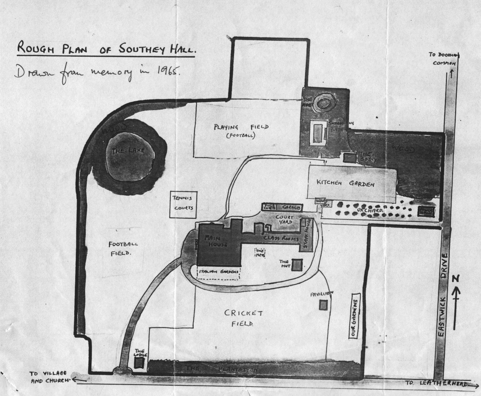
A map of Southey
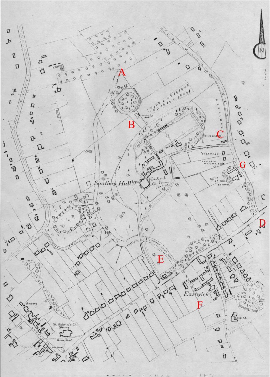
Hall in the 1930's drawn from memory This map below, which is dated 1957, shows Southey Hall with the name of 'Eastwick Primary School' written in by hand. It also shows the proposed new development that was scheduled with some plots of land already marked out. The actual map used for these outlines is pre-war as it shows The Lodge of Southey Hall as being situated on Lower Road when the house was actually demolished by a bomb dropped during WW2. We can see that the proposed new road, Eastwick Park Avenue, has been drawn in to run from Lower Road (E) through the grounds, past the Moat and the outdoor pool (B) and eventually emerging on Eastwick Drive (A). The building which housed the generator for electricity to the school is still evident by the back entrance (C) and just below that we can see The Spinney School (G). The density of housing along Lower Road (D) is quite sparse and it is interesting to note that the collection of houses along Eastwick Road (F) (now called East Street) have been referred to on this map as 'Eastwick'. This is the first reference I have obtained that gives an indication of a recognized community of Eastwick.
|
|